Skip to content
THE EXPLORER’S FIELD GUIDEOVER THE HILLWIKI & GUIDES
Mountain valleys and autumn forest in Over the Hill
THE ROAD IS ONLY THE BEGINNING

Over The Hill Maps - Explore Canada & Algeria

Find your next vehicle unlock, a missing crate or a place to photograph wildlife. Explore five game maps with challenge checkpoints, recovery jobs and meteorite spawn positions.

Two worlds. Plenty of detours.
THE EXPLORER’S ATLAS

Pick a place. Find your way.

Five real game maps. Find your next unlock.
Crates, challenge trails, recovery jobs and wildlife.

THE VALHALLAS / CANADA

Emerald Lake

Terrain layers +
GROUND CONDITIONS

Highlighted areas describe terrain, not live weather or a guaranteed safe route.

Emerald Lake satellite terrain view
100%
YOUR NEXT DETOUR

Choose a pin or a stop from the list

Open a location to check rewards and discovery status. Enable wildlife or meteorite spawns when you need them; nearby spawn positions group together until you zoom in.

Drag to move · Scroll or pinch to zoom · Keyboard: arrow keys, + / − and Home. Positions are navigation aids, not turn-by-turn routes.

86 crates · 14 recovery jobs · 23 challenge sequences · 730 possible wildlife spawns · 212 possible meteorite spawns. Wildlife records are shared by species, not by spawn position. Meteorites use the post-patch build 25992246 import, checked October 19, 2026. Neither spawn layer guarantees an encounter. Game map artwork © Funselektor and Strelka Games.

FIND YOUR NEXT HORIZON

Choose your landscape

2 regions covered here, with Emerald Lake listed alongside four further release areas below.

Over the Hill Canada landscapeREGION 01
THE NORTHERN WILDERNESS

Canada

Canada combines forest tracks, lakesides and mountain terrain, with cabins and viewpoints to discover between driving objectives.

ForestsLakesMountain tracks
ON THE TRAIL

Canada contains Emerald Lake, Gimli Ridge and Asgard Mountain. Each area has its own cabins, viewpoints and challenge trails.

Browse Emerald Lake
Over the Hill Algeria landscapeREGION 02
THE DESERT BEYOND

Algeria

Algeria’s desert landscapes include dunes, rocky corridors, canyon ledges and natural arches.

DunesCanyonsRock formations
ON THE TRAIL

Planks help cross gaps; the winch is for recovery when a vehicle gets stuck. Check the equipment list before choosing what to carry.

Pack your trail gear
FIVE RELEASE AREAS

Maps, stops and challenge trails

Three areas in Canada, two in Algeria. Each image is a game map texture without added location markers.

Emerald Lake in-game topographic mapCANADA / RELEASE AREA
IN-GAME TOPOGRAPHIC MAP

Emerald Lake

THE VALHALLAS / CANADA

Emerald Lake

A lakeside Canadian area with six cabins, two watchtower viewpoints and three challenge trails. Windy Joe and Hermit Trail connect exploration to vehicle unlocks.

Release map locations
Reward crates
18
Scenic points
2
Cabins / camps
6
Challenge trails
3

Cabins and camps

Pavilion Lake Cabin · Birch Grove Hut · Elizabeth Lake Cabin · Brew Hut · Black Bear's Den · Malachite Lodge

Scenic points

Clark Watchtower · Harrison Watchtower

Challenge trails

Windy Joe Trail · Elizabeth Oath Trail · Hermit Trail

Visit cabins and camps as you explore. Use the interactive map above to locate these stops; challenge lines connect the ordered checkpoints, rather than tracing a driveable road.

Check vehicle rewards
Gimli Ridge in-game topographic mapCANADA / RELEASE AREA
IN-GAME TOPOGRAPHIC MAP

Gimli Ridge

THE VALHALLAS / CANADA

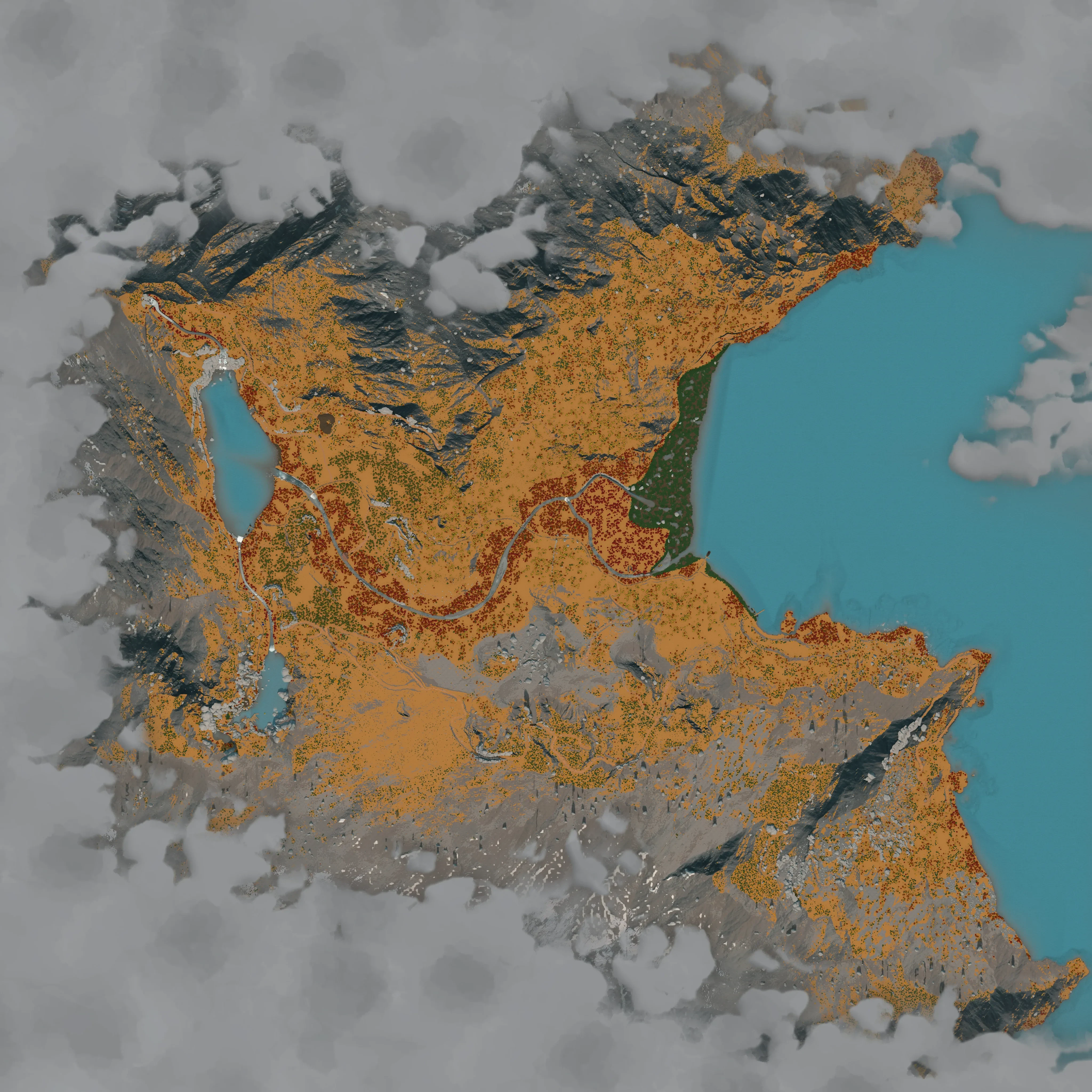
Gimli Ridge

The second Canadian area adds ridge routes, lakes and nine cabins. Its challenges include the unlocks for Blast Wagon, Brick and Polyana.

Release map locations
Reward crates
15
Scenic points
8
Cabins / camps
9
Challenge trails
5

Cabins and camps

Sunset Landing Cabin · Nerthus Cabin · Secluded Marsh Bunkie · Valkyr Lodge · Lake View Cabin · Powder Creek Lodge · Seer Lodge · Mount Gibson Lodge · Whitecap Alpine Lodge

Scenic points

Nerthus Observation Tower · Mount Robinson Viewpoint · Fisherman's Cove · Lucy Chapman Lake View · Mimisbrunnr Lake Overlook · Murray Peak · Beatrice Ridge · Clark Watchtower

Challenge trails

Fraser Research Boardwalk · Windcall Gorge Trail · Bridal Veil Falls Climb · Elvis Rim Trail · Waddington Scree Trail

Visit cabins and camps as you explore. Use the interactive map above to locate these stops; challenge lines connect the ordered checkpoints, rather than tracing a driveable road.
Check vehicle rewards
Asgard Mountain in-game topographic mapCANADA / RELEASE AREA
IN-GAME TOPOGRAPHIC MAP

Asgard Mountain

THE VALHALLAS / CANADA

Asgard Mountain

A higher mountain area with snowy ground and narrow climbing routes. Several challenge trails award vehicles, including Grand Woodman and Mammoth.

Release map locations
Reward crates
15
Scenic points
8
Cabins / camps
9
Challenge trails
5

Cabins and camps

Shaughnessy Cabin · Ridgeline Rest · Eagle Perch Cabin · Twin Pools Cabin · Rock Cradle Cabin · Crossroads Shelter · Mjoll Basin Lodge · Similkameen Lodge · Gods' Rest

Scenic points

Rock Cradle Weather Station · Eaglewing Ridge · Pemberton Point · Bighorn Lake · Heimdall Eye · Jormungandr's Coil · Headless Valley · Niflhel Bath

Challenge trails

Blanshard Ridge Trail · Asulkan Lake Highline · Lower Midgar Trail · Midgar Ascent · Wakefield Switchback Climb

Visit cabins and camps as you explore. Use the interactive map above to locate these stops; challenge lines connect the ordered checkpoints, rather than tracing a driveable road.

Check vehicle rewards
Tassili n’Ajjer Desert in-game topographic mapALGERIA / RELEASE AREA
IN-GAME TOPOGRAPHIC MAP

Tassili n’Ajjer Desert

ALGERIA

Tassili n’Ajjer Desert

The larger Algerian desert area combines sand, rock formations and canyon routes. Its ascents unlock Wombat, Woodman, Boar and Marshal.

Release map locations
Reward crates
21
Scenic points
14
Cabins / camps
10
Challenge trails
5

Cabins and camps

Porte Du Desert Camp · Istirahat El Hajj Camp · Sama El Sakhr Camp · Gharib El Kathib Camp · Oued El Ghubar Camp · Shaka Bivouac · Thuban El Milh Camp · El Kalaa Outpost · Foret De Pierres Camp · Shabah El Raml Camp

Scenic points

Oued El Zumurrud · Bab El Hajj · Jisr El Ajib · Sama El Sakhr · Buried Giants I · Tariq El Qawafil · Jisr El Rai · Tahaddi El Saqr · Grand Erg Occidental · Buried Giants II · Qatrat El Sama · Buried Giants III: Overlook · El Kalaa Overlook · Thuban El Milh Overlook

Challenge trails

El Kalaa North Ascent · La Cathedrale Climb · El Kalaa South Ascent · Tarfa Ascent · Shabah Ascent

Visit cabins and camps as you explore. Use the interactive map above to locate these stops; challenge lines connect the ordered checkpoints, rather than tracing a driveable road.

Check vehicle rewards
Aurès Mountains in-game topographic mapALGERIA / RELEASE AREA
IN-GAME TOPOGRAPHIC MAP

Aurès Mountains

ALGERIA

Aurès Mountains

An Algerian mountain area with aqueduct scenery, five camps and two challenge trails. A tunnel links it to the desert area.

Release map locations
Reward crates
16
Scenic points
8
Cabins / camps
9
Challenge trails
5

Cabins and camps

El Madraj Base Camp · Ajanib Camp · Great Aqueduct Camp · Hamra Plateau Camp · Taht El Borj Camp · Tlata Qnater Camp · Yamina Falls Rest · Mahrouqa Bivouac · Camp De La Trompe

Scenic points

Bordj Lalla · Marcellian Aqueduct View · Sarw Wahid · Saturn's Column · Southwest Overlook · Marabout Hill · Ancient Beacons · Clock of Eternity

Challenge trails

Djebel Rahmani Trail · Kalaa Ulya Track · Ukhtayn Route · Jazira Ascent · Mahrouqa West Track

Visit cabins and camps as you explore. Use the interactive map above to locate these stops; challenge lines connect the ordered checkpoints, rather than tracing a driveable road.

Check vehicle rewards
01 / THE LAY OF THE LAND

Handcrafted areas

Regions contain individual, handcrafted areas. Emerald Lake is an area within Canada, not a third region.

02 / THE NEXT STRETCH

Travel through portals

Discover portals to travel between areas. The landscapes shown above are overviews, not connected route maps.

03 / THE SMALL DETOURS

Weather and time of day

Dynamic weather and the day/night cycle change conditions during a drive. A screenshot shows one moment rather than a permanent view of the area.

BEFORE YOU HEAD OUT

A few map essentials

A little orientation before the next turn.

Are the maps procedurally generated?

No. The areas are handcrafted.

Is this one continuous open world?

The world uses area-based maps grouped within regions. Portals let you travel between areas.

What can I find on the interactive map?

Switch between five game maps to find cabins, viewpoints, challenge checkpoints, crates, recovery jobs, mechanics and area exits. Wildlife and meteorite layers show possible spawn positions. Search names or vehicle rewards, then mark places you have found. Progress stays in this browser and does not sync with the game. Photographed animals are tracked once per species, across all five maps. Meteorite positions use the post-patch import; a pin does not mean a meteorite is currently present.

Can I switch the map view?

Yes. All five areas have a colour satellite terrain view and an in-game topographic map. Open Terrain layers to highlight the ground conditions available for that area. These overlays describe terrain; they do not show the current weather in your session.

Can I share a pin or keep my own notes?

Select a location and choose Share map to copy a link to that area and pin. Add note lets you leave a reminder at a position you choose. Notes and discovery records stay in this browser and are not included in the shared link.

Does the measuring tool follow roads?

No. Measure connects the positions you select and adds their straight-line distances on the map. Hills, bends and obstacles can make a drive much longer. Measurements are temporary; save a note if you want a reminder for your next visit.